Dear Ms. Smartphone: I recently graduated from college and went to work in real estate. It’s a small office on a busy street. At least twice a week people come in asking for a paper map of our community. I guess my office used to do this. But, I don’t understand the need. Didn’t the Internet make paper maps obsolete? It’s easy to see all the open-houses on an app. Plus Google maps then provides the driving or walking directions to get to them. Am I missing something? Daniel, Boston
Dear Daniel: Perhaps your office is missing out on a “goodwill” marketing opportunity! There is irony that we want to shop local, but have to rely on a big national digital map service to identify these places! GenX, GenZ, and Baby Boomers might find agreement on this one.
Local businesses, many of them realtors, used to hand out one-page community maps. These local maps were sponsored (paid for) by display ads from merchants who inserted an ad or a landing dot on the layout. Surely most of these maps got tossed, but for a few, perhaps a souvenir? More likely, for newcomers and tourists, these inexpensive maps served as both an orienting tool and an initial intro to local business.
Migration of Advertising
Today that local advertising has migrated from newspapers and free-maps to Internet ads. They are surely less comprehensive than the the old yellow page directory and can lead viewers looking for local information astray, as I have previously noted. But as you say, digital maps do offer brand new features that leave static maps in the dust. I posit that we are looking at two different cognitive streams and ways of interpreting data. Both of them are useful for your walk-in real estate clients.
First, the paper map gives viewers the big picture, a birds eye view, e.g., the layout of the entire community. That’s helpful when they want to assess the proximity of say parks, schools, and open spaces and triangulate an optimal place to settle. As people seek more sustainable ways move about, they need to picture a home within the larger neighborhoods that surround it. The maps on our phones make it hard too zoom out to these levels. They also help drivers, like me, assess the “Champs Elysees” effect- namely thoroughfares that tee off on 45 degree tangents.
The Case for Digital:
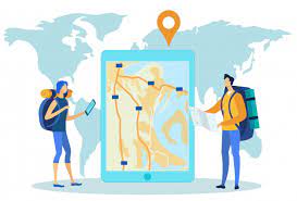
But, a digital map offers more information in terms of getting from point A to point B, and optimizing the travel route. It is a remarkable feature that enables turn-by-turn, or step-by-step directions. It might be safer too, since there are voice commands to guide us without looking down. Digital maps help drivers and pedestrians alike can anticipate what’s up ahead. The digital map can do many things not found on paper- it will display elevations, street views, and importantly, up-to-date road closures. These are new found advantages. And, instead of getting lost, we get to explore new arenas and neighborhoods!
Two Channels & One Stream:
So, both digital maps and paper ones provide useful visualizations, but we process their information in separate channels. We need to use them as complements, for different audiences and different applications.
There is a big map store in your area, called Ward Maps, and it is still open. Success. The concierge at bigger hotels probably hand out one-page flat maps too. The autoclub would be another source for a paper map, but these layouts are oriented towards driving routes, not neighborhood businesses. Finally, a City Hall department (transportation?) might be another place to check for community maps. If you don’t find a suitable map to hand out in your real estate office, perhaps it’s time to imprint your own. Missing a map as a missed opportunity?
Leave a Reply
You must be logged in to post a comment.